
For more than two decades, MBARI scientists and a team of international collaborators have been working to answer questions about the processes that shape the seafloor in the Arctic. Central to this work are innovative technologies developed by MBARI engineers.
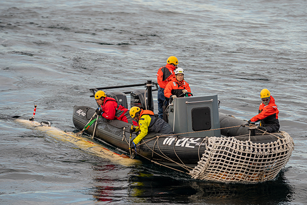
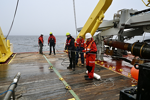
In 2025, 16 researchers from MBARI’s Continental Margin Processes Team, Seafloor Mapping Lab, CoMPAS Lab, and Seafloor Processes Team participated in a 30-day leg aboard the ice-breaking research vessel (IBRV) Araon operated by the Korea Polar Research Institute (KOPRI). The expedition also included longtime partners from the Geological Survey of Canada and other collaborators.
MBARI’s advanced technology is transforming our understanding of seafloor processes in a region of the Arctic that is remote, yet changing rapidly. Returning to the Arctic in 2025 provided new pieces of the puzzle while sparking new questions.
A longtime collaboration
Since 2003, MBARI has been part of an international collaboration with the Geological Survey of Canada, Fisheries and Oceans Canada, and since 2013, KOPRI to study the seafloor at the edge of the Canadian Arctic shelf. This remote area only recently became accessible to scientists as warmer temperatures caused sea ice to retreat.
A mapping survey by Canadian researchers in 2010 first uncovered the region’s distinctively rugged seafloor terrain—pingos (conical mounds associated with ground ice formation), craters, slide scars, and mud volcanoes. MBARI researchers have since participated in nine expeditions to the Canadian Beaufort Sea, leveraging our advanced technology to understand the processes sculpting the seafloor in this region.
The complex morphology of the seafloor in this region of the Arctic tells a story that involves both the melting of ancient permafrost that was submerged beneath the sea long ago and the deformation of the modern seafloor that occurs when released water refreezes. These dramatic and ongoing seafloor changes have major implications for policymakers who need to make decisions about underwater infrastructure in the Arctic.
Returning to the Arctic
The 2025 expedition enlisted a diverse array of MBARI technologies to better understand the dynamics of underwater permafrost formation and decomposition. The team aimed to map and sample more widely in the area to determine how extensive this ongoing deformation is and whether this permafrost ice contains greenhouse gases.
They began with multibeam mapping to chart the seafloor, sub-bottom profiling to peer beneath the sediments, and a series of gravity cores and multi-cores from IBRV Araon to recover sediment samples. From these cores, geologists extracted porewater for geochemical analyses, and in several gravity cores, they even found ice embedded within the sediment.
MBARI’s advanced technology allowed for targeted, high-resolution research along the flanks of the Mackenzie Trough, a 130-kilometer (80-mile) underwater glacial valley in the western Canadian Beaufort Sea.
Mapping the Arctic seafloor
Detailed maps of the seafloor provide critical context for science operations in the Arctic. MBARI’s seafloor mapping autonomous underwater vehicle (AUV) is outfitted with sonar instrumentation that can visualize seafloor features at meter-scale resolution, detecting features about the size of a dining room table. Scientists can use maps from these vehicles to identify specific locations for further study. Repeated surveys of the same area also reveal how seafloor terrain changes over time.
During the 2025 expedition, members of MBARI’s Seafloor Mapping Lab, Autonomous Systems Operations Group, and Electrical Engineering Group coordinated two surveys with the seafloor mapping AUV Mapper 1 at research sites in shallow waters near the shelf edge—the Gary Knolls underwater mounds had previously only been mapped in low resolution by ships, while the western edge of the Mackenzie Trough had not been mapped with AUVs since 2017.
These new data provided a fresh perspective on the subtle features and processes shaping this part of the continental shelf. By comparing them to bathymetry data collected over decades of research in this region, the team will be able to quantitatively measure how the seafloor has changed over the past eight years.
Surveying the crests of pingos
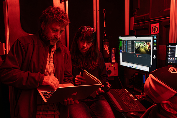
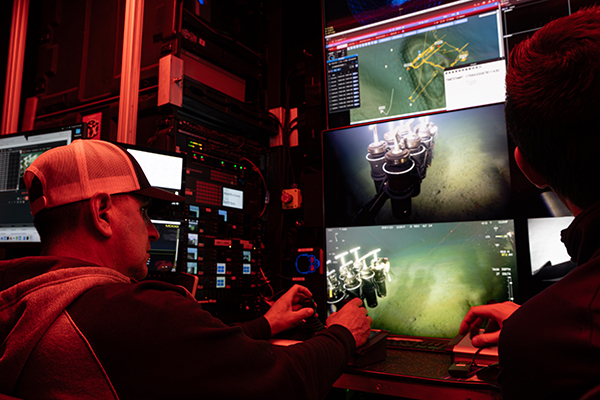
MBARI’s MiniROV is a nimble remotely operated vehicle with cameras and sampling equipment that can be configured for a variety of science missions and operated from a portable control room on the deck of IBRV Araon. This vehicle enables visual observations of seafloor features, can collect samples of sediment and ice, and is equipped with sensors to log temperature and salinity.
The continental shelf edge on the western flank of the Mackenzie Trough is studded with pingos, mounds formed as ice pushes up through the seafloor. Comparing maps from previous MBARI AUV surveys with data collected during this expedition, the team learned that craters on the crests of some pingos sank deeper while others grew taller, helping them identify sites for closer study. They conducted five surveys with the MiniROV to better understand the mechanisms driving changes between 2017 and 2025.
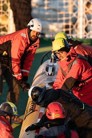
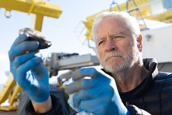
MBARI researchers used the MiniROV to collect sediment samples with push cores from the pingo crests. Prior to the expedition, technicians in MBARI’s Manufacturing Group created a custom ice-coring tool, allowing the MiniROV to drill into exposed ice formations and retrieve samples for further study in the lab. These samples will be compared to cores collected by the team aboard IBRV Araon.
Thanks to MBARI’s skilled pilots and engineers, the expedition team was able to gather invaluable observations and samples of the Arctic seafloor. The data they logged during their surveys will help advance our understanding of the active decomposition and formation of submarine permafrost.
Piloting new mapping and navigation technology
The MiniROV received an upgrade from MBARI’s CoMPAS Lab for the 2025 expedition.

The new Arctic mapping sled includes seven optical and acoustic imaging systems, capable of visualizing the seafloor at centimeter-scale and gathering quantitative measurements of underwater features like pingos and craters. This new capability will help researchers determine the rates of subseafloor deformation created by the freezing and thawing of near-seafloor ice.
The mapping sled also includes high-precision navigation sensors, allowing the vehicle to take advantage of simultaneous localization and mapping (SLAM) techniques. Frequently used to generate real-time maps of terrestrial terrain as a vehicle moves in or above an environment, CoMPAS Lab engineers have adapted SLAM to navigate in complex underwater environments. Sensors on the sled track the MiniROV’s position and orientation, and then SLAM stitches together visual information from the cameras in real time to create centimeter-resolution maps.
Importantly, this expedition was a critical field test for developing the CoMPAS Lab’s low-cost, adaptable sensors for high-resolution, autonomous seafloor mapping. MBARI’s state-of-the-art sensors and software are transforming the mapping of the seafloor. Adapting these powerful tools for use on smaller robots will be a major leap forward in ocean exploration.
Revealing ice beneath the seafloor
In addition to mobilizing MBARI’s advanced underwater robots, the team used a controlled-source electromagnetic (CSEM) system launched from IBRV Araon to determine the extent and distribution of submarine permafrost. On loan from the University of Malta and upgraded by MBARI engineers, CSEM technology can detect ice and brackish water buried in submarine sediments.
Different types of sediments respond distinctively to electrical signals. The CSEM system collects information about the electrical properties of the sediments up to 500 meters (1,640 feet) below the seafloor. A low-power dipole transmitter is towed behind the ship, generating an electromagnetic field. A series of receivers towed further behind capture the returning signal. Variations in the measured field reflect subtle changes in the resistivity of the subsurface sediments, helping researchers determine where there is ice. During the expedition, MBARI researchers conducted three CSEM surveys. These electromagnetic data will allow our researchers to identify areas with ice and groundwater.
With the addition of CSEM technology, the expedition team was able to get a comprehensive picture of the Arctic seafloor using a diverse suite of technologies.
A critical moment for the cryosphere
Ice-covered environments host unique communities of life and are integral to the health of our planet. Collectively known as the cryosphere, glaciers, snow cover, ice sheets, sea ice, and permafrost are experiencing rapid changes as our planet continues to warm.
This year marks the opening of the United Nations Decade of Action for Cryospheric Sciences, an international initiative that aims to better understand and protect critically important polar environments. MBARI’s ongoing research in the Arctic is one of several projects contributing to global efforts to take the pulse of polar regions.
MBARI’s work in the Arctic is establishing a critical baseline to assess and track the impacts of climate change on this region. Our findings from more than 20 years of research provide a valuable historical context to help us begin to understand what the future may hold.
“Innovative MBARI technology has allowed us to map one of the most remote regions on Earth, transforming our understanding of processes that sculpt the seafloor in the Arctic.”
—Senior Scientist Charlie Paull