International collaboration seeks to document rapid changes to the deep seafloor in the Arctic
For nearly 20 years, MBARI has collaborated with researchers at the Geological Survey of Canada, the Department of Fisheries and Oceanography Canada, and, more recently, the Korean Polar Research Institute to study the frigid waters of the Canadian Beaufort Sea. This remote area of the Arctic has only recently become accessible for scientists as climate change drives the retreat of sea ice.
Our collaborative research in the Canadian Beaufort Sea has revealed a remarkable diversity of seafloor features on the outer shelf and upper continental slope. Geologist Charlie Paull and his team believe these features are linked to the ongoing degradation of relict permafrost under the shelf, rapid deposition of glacial sediments, expulsion of brackish waters, and formation of ground ice within the sediments near the seafloor. The dynamic and dramatic changes to the seafloor have significant environmental and geohazard implications and may be unique to the Arctic setting.
This summer, MBARI will return to the Arctic as part of an international expedition aboard the Korean icebreaker ship, the R/V Araon. This trip with our Canadian and Korean collaborators—with the addition of the United States Naval Research Laboratory—will help refine our understanding of the decay of submarine permafrost, high-latitude methane fluxes, and the slope stability of the Arctic continental margin.
The expedition will utilize MBARI technology to better understand the Arctic environment in the midst of rapid change.
Two of MBARI’s autonomous underwater vehicles (AUVs) will map the seafloor in remarkable detail. Our mapping AUVs can resolve the bathymetry of the seafloor down to a resolution of a one-meter (about three-feet) square grid. Repeat mapping on previous expeditions has revealed a dynamic seafloor—changes are rapid enough to be detected over two-year periods. It is critical to understand why these changes are happening now, why they might be occurring so rapidly, and whether they are associated with recent anthropogenic influence.
MBARI’s MiniROV, a portable remotely operated vehicle, will enable further exploration and sampling to complement the mapping surveys.
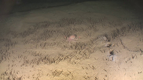
Paull hopes to use the MiniROV to look for methane emerging from the seafloor as submarine permafrost decomposes. His team will be looking for evidence of methane seepage, both biological indicators, such as changes in animal communities, as well as chemical signatures from radium and barium isotopes. The MiniROV has proven particularly adept at sampling gas bubbles and plumes emanating from the seafloor and will be a critical tool for this work.
Learning about the fragile Arctic environment before it becomes further altered by an expanding human presence is especially important and urgent. This expedition exemplifies MBARI’s mission to advance ocean science and technology to understand a changing ocean.
“Repeated bathymetric surveys using MBARI’s mapping autonomous underwater vehicles have revealed that numerous huge craters are forming on the seafloor in a remote area along the edge of the Arctic Ocean. These morphological changes are among the most rapidly occurring anywhere on the Earth.” —MBARI Senior Scientist Charlie Paull