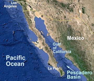
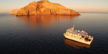
Seafloor mapping will be a large part of this expedition. Two MBARI mapping autonomous underwater vehicles (AUVs), operated from the R/V Rachel Carson, will provide high-resolution bathymetric maps to help direct subsequent remotely operated vehicle (ROV) operations. A lidar (laser) system mounted on the ROV Doc Ricketts will also be used to provide the scientists with one-centimeter (half-inch) resolution maps. Maps that the AUVs and ROV collect will be used to comprehensively investigate the hydrothermal vent fields that MBARI teams previously discovered in the Pescadero Basin and along the Alarcón Rise.
ROV operations will be conducted off the R/V Western Flyer using both the MiniROV and ROV Doc Ricketts. In addition to MBARI’s suite of robots, the i2MAP (Investigations of Imaging for Midwater Autonomous Platforms) will be used in the Gulf of California for the first time. The i2MAP is equipped with a bioacoustic sensor and a high-resolution camera placed in the nose cone of an AUV. Transects using the i2MAP will allow researchers to estimate the abundance of biological populations within the region. This robotic fleet will give researchers the information needed to further expand our understanding of life in the sea and how it is changing over time.
The expedition’s biological oceanographic studies will focus on the unique diversity and evolutionary history of midwater and seafloor animals. MBARI’s flotilla of autonomous and remotely operated vehicles will also examine animals that are tolerant of low-oxygen conditions in the southern and central Gulf of California basins, continuing to unravel the mysteries of the oxygen minimum zone.


